Have you ever seen a picture that makes you feel like you're soaking up the warm Caribbean sun? These beach scenes show off bright turquoise waves, soft sand, and crystal clear skies that come alive right before your eyes. Each photo is like an open door to a world filled with calm and natural beauty. It’s a little taste of paradise you can enjoy without even leaving your home. So, take a moment to wander through this collection and let the island vibes refresh your senses.
Caribbean islands images: Stunning beach scenes
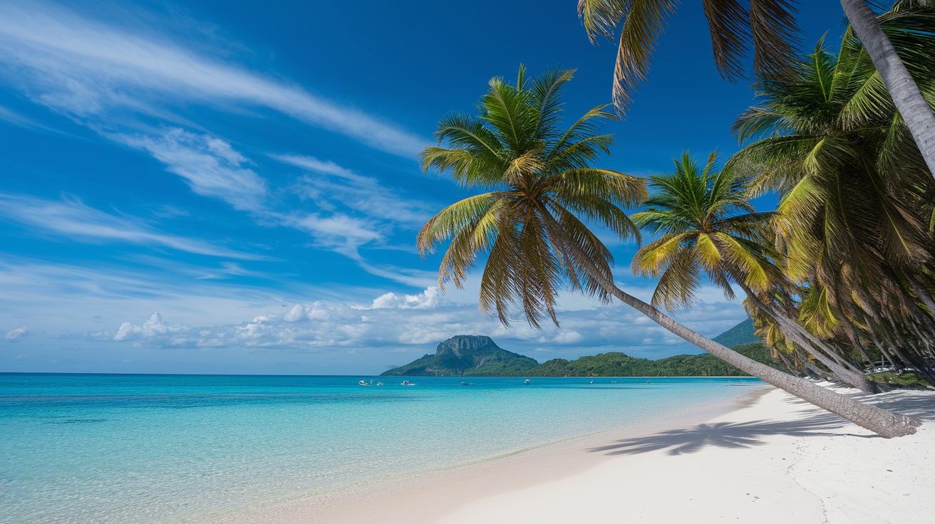
Step into a world of vibrant island views where sun-kissed beaches and sparkling blue waters invite you to imagine yourself on a dreamy tropical escape. Each picture in the gallery is like a mini adventure, showing off brilliant colors, clear ocean views, and lush green landscapes that pull you right into the heart of island life. Picture a sunny beach with water so blue it mirrors the sky, a perfect spot to relax and soak in the warmth of the day.
Next, let’s talk about some true showstoppers. Grace Bay Beach in Turks and Caicos charms with its famous turquoise waves, while snapshots from the Bahamas reveal a hidden treasure of over 700 islands. You might see the lively buzz of family hotspots like Atlantis Paradise Island or the calm, inviting waters of the Exumas, ideal for snorkeling and exploring beneath the surface. And don’t forget Anguilla’s untouched shores or the dramatic cliff views at Virgin Gorda that make you feel like you’ve stepped into a postcard.
Every caption is like a little guide, noting exactly where, when, and what makes each scene so special. For instance, a caption might read, "Grace Bay Beach at sunset – where soft light meets endless ocean," instantly giving you the vibe and transporting you to that serene Caribbean moment.
Aerial and Satellite Caribbean Island Imagery

Drone photography brings a fresh view of the islands, showing you sunlit scenes that feel like a gentle Caribbean breeze. Imagine a drone gliding over a shiny, clear bay and capturing all the curves of lively coastlines and secret little coves. It’s like getting a treasure map of the islands, one that even a weekend photographer can use to create vivid, immersive scenes. Fun fact: some drones can shoot ultra-wide, 4K videos so clear you can almost feel the ocean’s sparkle.
Then there’s satellite photography, which paints a big picture of the whole archipelago. These satellite views help you see how the islands connect, almost like a puzzle of tiny treasures. Whether it’s political maps with borders or giant wall maps, these images mix art and science by giving travelers a real bird’s-eye view of the Caribbean.
| Image Type | Source/Tool | Best Use |
|---|---|---|
| Drone Shot | Drone | Capturing bright coastal scenes and sunrise views |
| Satellite View | Google Earth | Viewing broad island groups from above |
| Political Map | GIS Software | Highlighting island borders and detailed territories |
| Wall Map | Printed Maps | Showing how islands fit together in the region |
Interactive map platforms make it even more fun to explore. With options to zoom, pan, and add layers of details, you can virtually travel around the Caribbean and feel like you’re right there, soaking up every vibrant moment.
Iconic Caribbean Beach Scenes and Coastal Vistas
Caribbean beach photos show more than just a pretty view. They capture the island spirit with playful light, movement, and vivid colors.
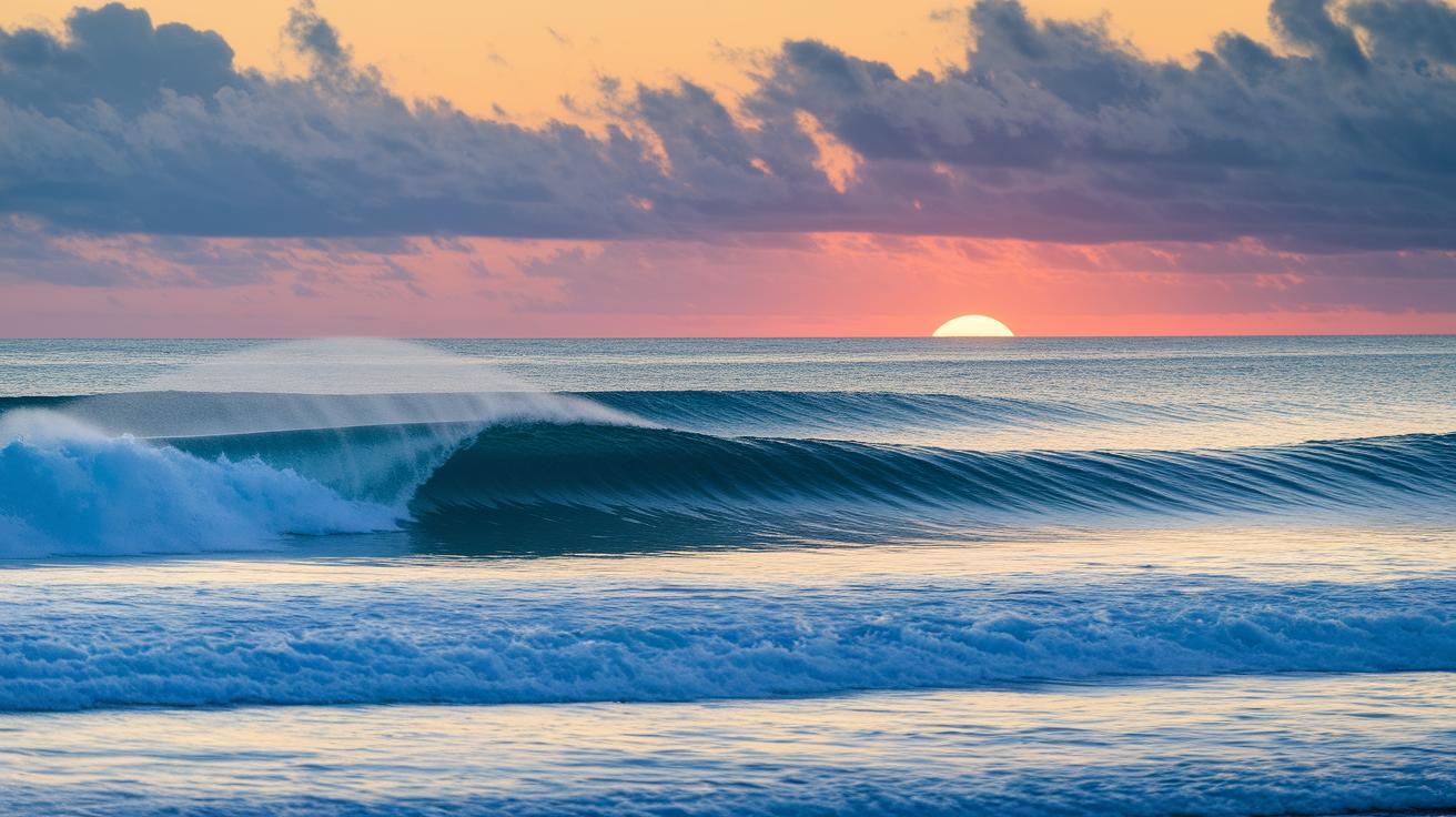
At sunrise, soft pastel skies meet calm turquoise waters, setting a magical scene. In Anguilla, locals set their cameras to a slow shutter speed so that the waves turn into a smooth, silky dance. Try it out, set your shutter to slow and watch the light and shadows glide over the water, unveiling the quiet magic of early morning.
When sunset arrives, islands like Grace Bay light up with deep, rich colors and bold contrasts. The dance of light and shadow brings out the textures along the shoreline and highlights water reflections. Experiment with different angles to capture the rugged curves of the coast alongside the steady shimmer of the sea.
Showcasing Caribbean Island Culture Through Photography
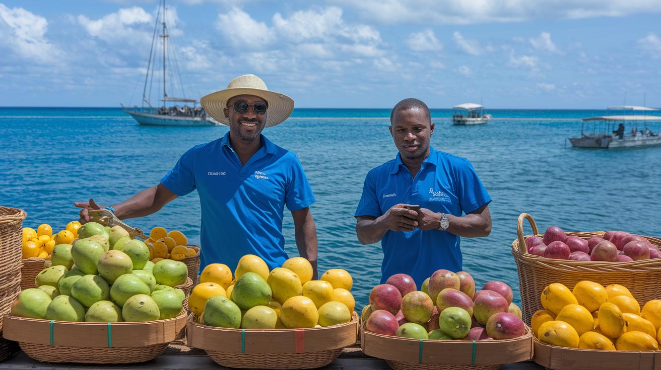
Caribbean culture truly sparkles in photos that show not just pretty scenes but also the everyday spirit of island life. Imagine strolling through a bustling village market, where locals laugh and chat while picking out fresh fruits and veggies, or watching a colorful boat festival in Trinidad where music fills the air and the harbor bursts with life. These snapshots give you a taste of traditions passed down through generations and invite you to feel the warmth of local heritage. And then there are moments like the fun, quirky swim-with-pigs tours in the Exumas or the lively snorkeling trips at Thunderball Grotto in the Bahamas – each one tells its own vibrant story.
- Market scenes
- Boat processions
- Festival parades
- Street food stalls
- Local musicians
- Night celebrations
Each of these themes brings out its own special charm. Market scenes capture the everyday hustle and genuine smiles of both vendors and visitors. Boat processions show just how deeply island communities are connected to the sea. Festival parades and street food stalls tease out layers of history and taste, while local musicians add a rhythmic pulse that makes every image sing. And when night falls, celebrations light up with an energy that’s impossible to forget.
When you write captions to go with these photos, think about adding fun details like the location, the time of day, or any special festivities happening. For instance, a caption might read, "Traditional boat parade in Trinidad – lights, laughter, and a deep sense of community." It's a simple way to draw your audience into the story behind each shot.
Cartographic Caribbean Island Map Views

Detailed Caribbean maps give you a clear look at island shapes and coastlines. New map designs mix official borders with natural land forms to create tropical charts filled with helpful notes that share each region's unique story. High-up views cover everything, from rugged shores to winding inland roads, so you can easily spot hidden villages or sparkling beaches when planning your trip across Eastern, Western, Northern, or Southern Caribbean areas.
Today, many people use digital GIS maps (that’s just a fancy term for digital maps) to create guides with marked travel routes and clear coastline details. These maps blend a bit of science with a touch of artistry, making them perfect for planning a scenic drive or simply admiring the view of a tropical paradise.
For those looking to expand their map toolkit, here are a few recommended resources:
- Atlas collections with detailed political outlines
- Interactive digital maps featuring tropical notes
- High-altitude tools for wide, panoramic island views
Adding maps into your digital travel guides makes your journey feel interactive and vibrant. For example, linking to a "list of caribbean islands" can quickly guide you to more details about each spot, turning map visuals into an essential part of your Caribbean adventure.
Downloading and Using Caribbean Islands Images
Let's kick things off by making sure you're clear on using Caribbean images safely. Always check the image's license before you hit download so you know if it's free for personal or commercial use. For example, you might see a note saying "Free island wallpaper for both desktop and mobile," which reminds you to honor the photographer's work.
Next, explore free photo websites to find the perfect Caribbean snap. Sites like Unsplash and Pexels offer bright, high-resolution images that show off beautiful beach scenes, deep blue waters, and wide-open island views, ideal for any project. If you're looking for more travel photo ideas, have a look at https://mauisky.com?p=115, where you can search for tropical backgrounds and other dreamy visuals.
Finally, remember to resize and optimize your images so they look great on any device. Adjust the dimensions for desktop and mobile wallpapers to keep every detail sharp and clear. Play around with compression tools to balance quality and loading speed, ensuring your Caribbean scene shines beautifully on every screen.
Final Words
In the action, this post unraveled a vibrant gallery of Caribbean islands images, highlighting everything from dramatic aerial views to iconic beach scenes and cultural snapshots. The guide shared tips on capturing the magic of tropical coastlines, practical map views, and even tricks for snagging free, high-quality photos. Every section paints a picture of the sunshine, candid moments, and ease that comes with planning a memorable trip. Enjoy framing your own tropical memories with these caribbean islands images and let the beauty of the Caribbean light your way.
FAQ
Where can I find free, high-quality Caribbean images, photos, and wallpapers?
Free Caribbean images include stunning island scenes like white-sand beaches and turquoise waters. These visuals are available on free stock photo sites that offer downloads for personal or travel use.
How do Caribbean island maps and satellite images help picture the islands?
Caribbean island maps and satellite views offer clear layouts of the islands, showing boundaries and spatial details. They give you an accurate visual guide for planning trips or exploring the region.
What do pictures of the Caribbean sea typically showcase?
Pictures of the Caribbean sea often capture the clear, turquoise waters, contrasting vibrant blue hues with serene white sands, inviting viewers to experience the refreshing beauty of coastal island life firsthand.
Are there galleries that include images of Caribbean people and local life?
Yes, many galleries highlight Caribbean people and local scenes, showing everyday moments, cultural events, and community interactions that bring out the heart of island living.
Which is the prettiest Caribbean island to visit?
The prettiest Caribbean island is subjective, but many visitors praise islands like Grace Bay in Turks and Caicos for its breathtaking white-sand beaches and clear, warm waters.
What is often considered the safest Caribbean island to visit?
Safety in the Caribbean can vary, though many travelers feel comfortable on islands known for friendly locals and secure resorts. Research recent visitor reviews and local guidelines before planning your visit.
What does the term “13 Caribbean islands” refer to, and what might be included?
The phrase “13 Caribbean islands” typically points to a popular set of favorites. The list can vary, so it’s best to check travel guides that highlight top islands matching your personal interests.
What is the number one Caribbean island, according to travel sources?
The number one Caribbean island depends on preferences. Some travel sources spotlight islands like Grace Bay in Turks and Caicos for their unmatched beauty, while others emphasize lively local culture on different islands.